Heavy rain with flooding predicted. Stay out out of the arroys coming into and to Ajo and to CAborca. Who is up for a canoe ride down the Rio Soynoita ???
Looks to be a wet one, for sure! Even here in Tempe, I did a little trenching for runoff yesterday. Have had the patio flood during heavy rain in the past. Penasco is usually a real mess in heavy rain from what I've seen in the past.
I think it's coming fast. 8:30 or so today, Sunday, it was just a smudge on the horizon off to the SE. You had to really look to see it. At 9:30 it is a huge black cloud along the horizon. Swear I felt a drop or rain. Cloud cover now cumulus clouds, fairly windy. Sonoita will be flooded again for sure.
I would be canceling a visit for early in the week and packing to go home if I needed to leave soon.
Thunder and lightening at about midnight. Evidence of moderate rain during the night. No rain at 9 AM. Raining steady now at 10 AM. It it keeps up and or grows things will be WET.
We had monster T-storms come in Playa Encanto about 1AM and initially the rain rate hit 1.75 in/hr. Didn't last but a few minutes and precip intensity calmed down quite a bit the rest of the night. Since sunrise we have experienced periodic showers and total rain so far is 0.19 in.
Keep us posted... trying for a last ditch effort turn and burn trip Wednesday night... Fish Thursday and leave Friday mid day. Any reports out of Cholla Bay? Recent CB erosion and water damage with a similar storm not too long ago if I'm remembering correctly.
Been raining all evening. Big, medium and small. Thunder and litenin. Any where there has been runoff damage in the past, unless renovated, will be a swamp I think. Be a few days for water to sink in.
We, too, are currently (happily) socked in on the beach (Dorada), and can confirm that currently the beach road is impassable. Arrived Monday with the hope of timing into the forecasted short lull in the storm, and with the hope of finding the already-wet beach road still navigable. The washes on the Caborca Road were pretty dry -- but by now, certainly not. Our entry on the beach road was a controlled slide (4WD), as we passed marooned vehicles on the way. About an hour later, the rain returned, and continued all night. More is forecasted. For anyone thinking of visiting over the next number of days, the southeast beaches are out of reach. Also -- at Why on Monday -- a returning traveller claimed that Las Conchas was a mud bog.
We, too, are currently (happily) socked in on the beach (Dorada), and can confirm that currently the beach road is impassable. Arrived Monday with the hope of timing into the forecasted short lull in the storm, and with the hope of finding the already-wet beach road still navigable. The washes on the Caborca Road were pretty dry -- but by now, certainly not. Our entry on the beach road was a controlled slide (4WD), as we passed marooned vehicles on the way. About an hour later, the rain returned, and continued all night. More is forecasted. For anyone thinking of visiting over the next number of days, the southeast beaches are out of reach. Also -- at Why on Monday -- a returning traveller claimed that Las Conchas was a mud bog.
Seriously good advice even for people with off-road experience This road is solid caliche when dry and like grease when wet.
Does anyone have rainfall totals for RP? From the looks of things it had to be a lot.
Varied between 3.5 and 5" depending on the location. My local friend estimated 5" fell.
In his front yard it was 8-10" deep and was coming into his house, he lives 3/4 mile N. of Los Pinos hardware/lumber store.
Amazingly the dirt road going to the Reef and Cholla was repaired and drivable by 10AM today.
We just received almost 3 years of rainfall. We don't need any more water.
Agreed, but damn, the Southwest as a whole really needs this and a nice wet winter to help break (or at least stave off) this extreme drought cycle we've been in. I have to see it as good news!
True, but it would be good if we got enough of a break so the people stranded on the east beach island could get to town and restock the fridge. Hoping the weather channel girl is wrong on this one.
True, but it would be good if we got enough of a break so the people stranded on the east beach island could get to town and restock the fridge. Hoping the weather channel girl is wrong on this one.
Even when the water ever recedes I can't imagine what the Encanto road is going to be like, IF there is a road for us to get out of here.
Even when the water ever recedes I can't imagine what the Encanto road is going to be like, IF there is a road for us to get out of here.
That’s what I was thinking, and we’re hoping/planning on coming down next week. Best case it will be like it used to be 25 yrs ago when we first started coming to Encanto.
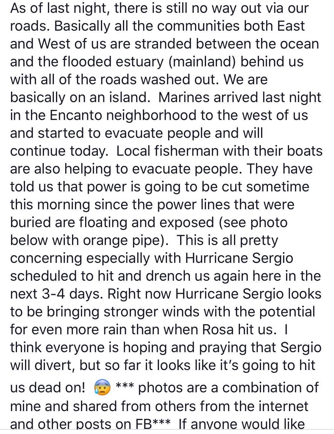
To make matters worse they are saying that we have an 80% chance of CFE cutting off our power in Encanto sometime this morning due to lines becoming exposed.
To make matters worse they are saying that we have an 80% chance of CFE cutting off our power in Encanto sometime this morning due to lines becoming exposed.
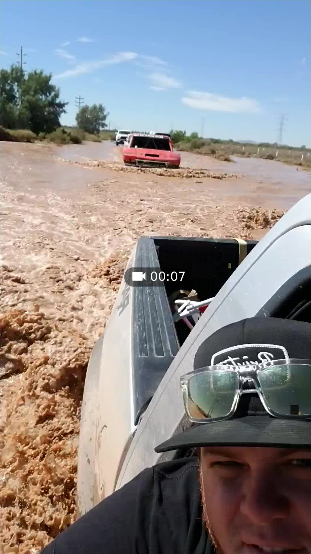
Perused the estuary this AM and talked to some newcomers (yes -- people arrived as of late). Dorada / Miramar Road still closed, although no longer submerged. Caborca Road Kilo 17 still impassable by smaller vehicles . . . . Large SUVs and Trucks can barely traverse, (A Honda CRV barely made it, despite that trucks going opposite direction generated waves up and over the hood). Learned that those heading to Dorada / Miramar / Mayan have:
1. Braved the Caborca wash via Jeep, etc . . . . then entered the Miramar Road via Mayan Palace. While some have made it as far eastward as Dorada, it is a white-knuckle ride through soft, deep sand behind the dunes.
2. Availed themselves of an apparent boat shuttle from town to Mayan (per my observation, as full boats go eastward and return empty).
Perused the estuary this AM and talked to some newcomers (yes -- people arrived as of late). Dorada / Miramar Road still closed, although no longer submerged. Caborca Road Kilo 17 still impassable by smaller vehicles . . . . Large SUVs and Trucks can barely traverse, (A Honda CRV barely made it, despite that trucks going opposite direction generated waves up and over the hood). Learned that those heading to Dorada / Miramar / Mayan have:
1. Braved the Caborca wash via Jeep, etc . . . . then entered the Miramar Road via Mayan Palace. While some have made it as far eastward as Dorada, it is a white-knuckle ride through soft, deep sand behind the dunes.
2. Availed themselves of an apparent boat shuttle from town to Mayan (per my observation, as full boats go eastward and return empty).
To make matters worse they are saying that we have an 80% chance of CFE cutting off our power in Encanto sometime this morning due to lines becoming exposed.
I was afraid that would be next. They wouldn’t restore power until the water receded enough to bury the lines which would be several days at best. I wonder if people still have backup power available? We still have our generator but haven’t maintained/started it in years. What a mess!
I was afraid that would be next. They wouldn’t restore power until the water receded enough to bury the lines which would be several days at best. I wonder if people still have backup power available? We still have our generator but haven’t maintained/started it in years. What a mess!
Generator or solar options, although most got rid of the solar when electricity became available. Good idea to run the generators periodically as a precaution.
Encanto is served by a transformer in Encanto. Dorada and Miramar are served by another transformer (the one at the entrance gate). Not sure that that is a consolation to those east of Encanto, but hoping that if one goes down, it does not necessarily include the other. Meanwhile, we too have the old generator to rely on if it responds to a kick on the side . .
PS: Miramar, if you end up doing a beach shuttle, be sure to stop by with passengers on your way (Dorada sea wall area) for a beer!
Generator or solar options, although most got rid of the solar when electricity became available. Good idea to run the generators periodically as a precaution.
Yeah, we keep saying we’re going to do it but there’s always so many other maintenance problems that take priority. Damn salt air! Radiator probably needs replaced by now, everyone else’s did, salt and aluminum don’t get along. Battery, hoses, coolant, oil change... Makes me appreciate the propane fridge’s we used to use.
Yeah, we keep saying we’re going to do it but there’s always so many other maintenance problems that take priority. Damn salt air! Radiator probably needs replaced by now, everyone else’s did, salt and aluminum don’t get along. Battery, hoses, coolant, oil change... Makes me appreciate the propane fridge’s we used to use.
Beach weather, sand, salt, wind are absolutely brutal on beach homes and equipment but it is even worse and more expensive if they are not given adequate periodic maintenance. Trust me on this.
I kept up on my generator that runs on propane (1000 L tank) and run it every time I come down. Just had it running last weekend. Also kept my solar and updated it a couple years ago to bidirectional so I'm always selling power back to CFE besides. So I s/b good no matter what.
I kept up on my generator that runs on propane (1000 L tank) and run it every time I come down. Just had it running last weekend. Also kept my solar and updated it a couple years ago to bidirectional so I'm always selling power back to CFE besides. So I s/b good no matter what.
Beach weather, sand, salt, wind are absolutely brutal on beach homes and equipment but it is even worse and more expensive if they are not given adequate periodic maintenance. Trust me on this.
Very true, but due to CFE being unbelievably dependable the generator maintenance has been moved to the back burner. We have been budgeting 11K annually for maintenance and the account is running on empty more times than not. That’s doing the maintenance in-house and hiring contractors only when needed. But the current incident reminds me that we need a backup plan in case of extended power outage so I’ll bring a battery down next week and get busy.
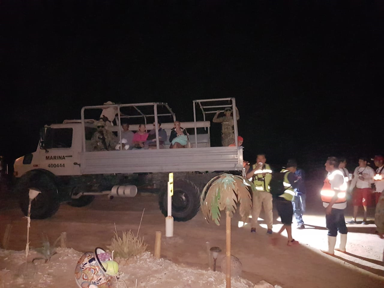
We were scheduled to come down on Saturday but held off, glad we did. I am wondering if the evacuees will have to leave their vehicles behind.
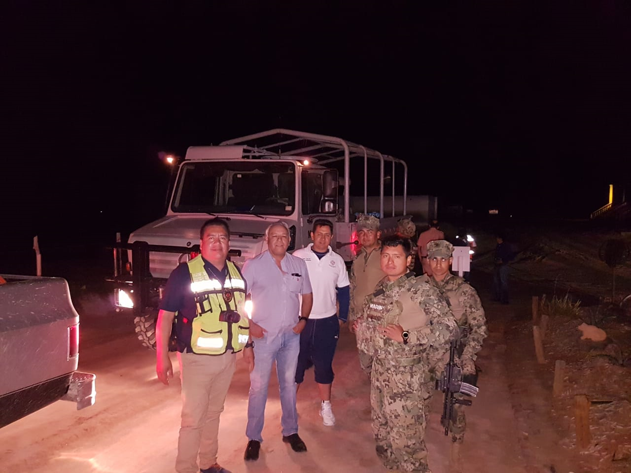
They have to leave them if it’s in the community. There’s no getting them out of here. Several had left their vehicles on the incoming road on the other side of where the river washed out the road. They will be able to retrieve them and drive back out to the highway.
I’m pretty sure that this will bring the best out in the majority of neighbors helping each other out. It will work out if everyone keeps their cool and cooperates. It isn’t the first time that the East beaches have experienced this.
Good Luck to all!
I talked to people this morning who saw what was posted , drove from Encanto to Luna Blanca on the beach and took the Mayan road out. Not sure if they went to caborca then sonoyta or penasco then sonoyta
We ran a race this weekend from sonoita to rocky point and they had the race cars take the hwy to cross the river. I was told it was 16” deep so I led the race truck thru the crossing in my raptor, the deepest part had a good current going and the back of my raptor started to float a little. Highly irresponsible move on our part and I’m just glad no one was rinsed off the road
Mondone, how much was the bi-directional conversion?
I needed an additional circuit board installed in my Outback and 4 new Rolls batteries (old one's where shot), and I replaced all the cables with new one's also. I think in total it ran about $1500.
I talked to people this morning who saw what was posted , drove from Encanto to Luna Blanca on the beach and took the Mayan road out. Not sure if they went to caborca then sonoyta or penasco then sonoyta
Just got back to Phoenix.
We went from Encanto to Mayan Road to Penasco this morning early. Two washes on the Highway were really deep !
I talked to people this morning who saw what was posted , drove from Encanto to Luna Blanca on the beach and took the Mayan road out. Not sure if they went to caborca then sonoyta or penasco then sonoyta[/QUOT
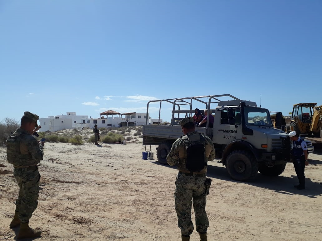
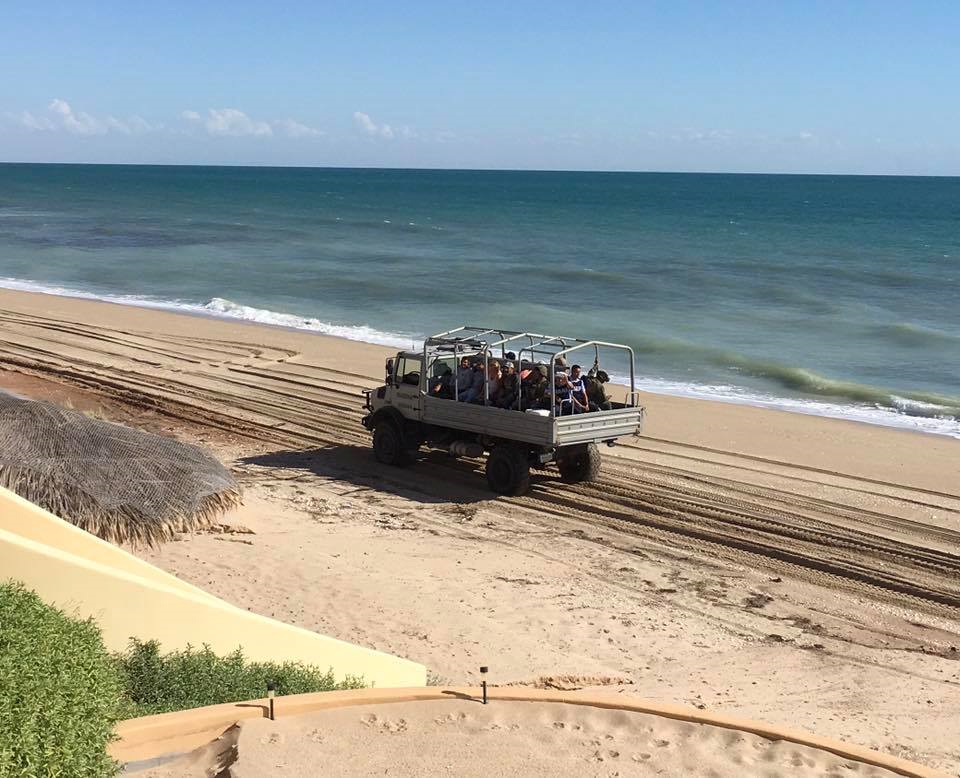
I was told that is not being condoned by the officials for anyone to do on their own.. The Marines were not able to get into Encanto this morning on our road to evacuate another group looking to get out and had to turn back. They are going to attempt coming in later today when the high tide recedes along the beach from the Mayan instead and they have OK'd anyone in Encanto with a 4 wheel drive vehicle to follow them back along the beach to the Mayan road.[/QUOTE]
The Caborca to myan route is perfect no issues the only problem is the river crossing between Myan and Penasco, we came that way during the race on sat
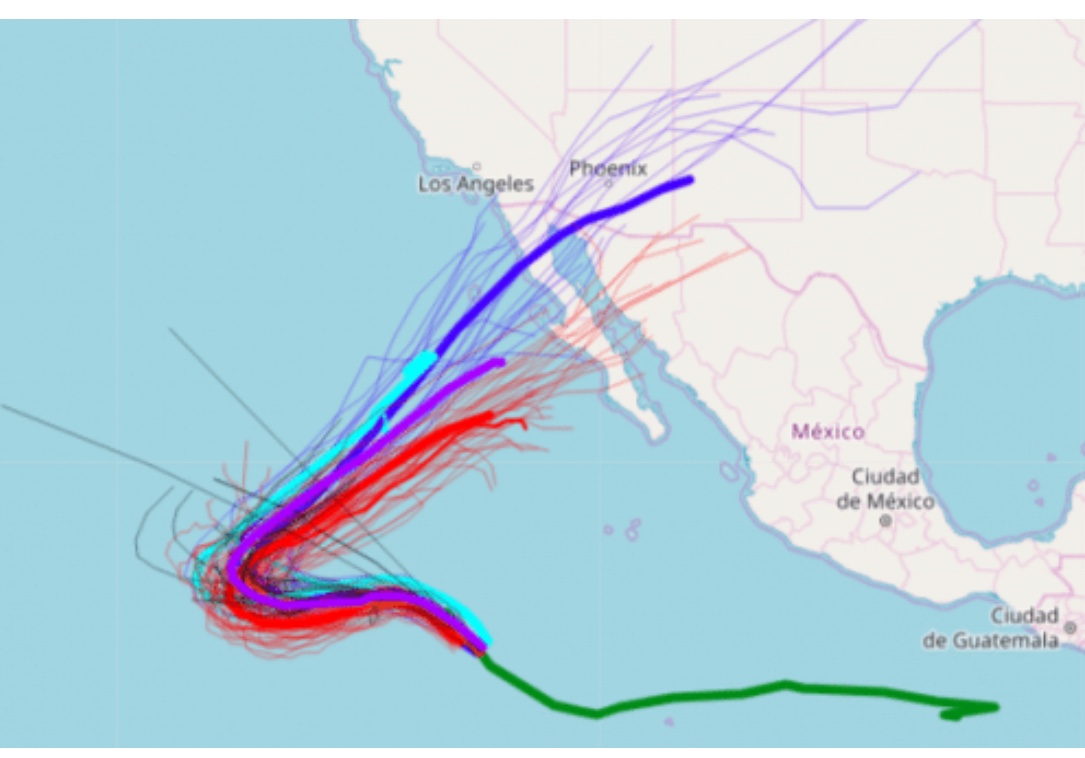
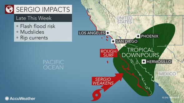
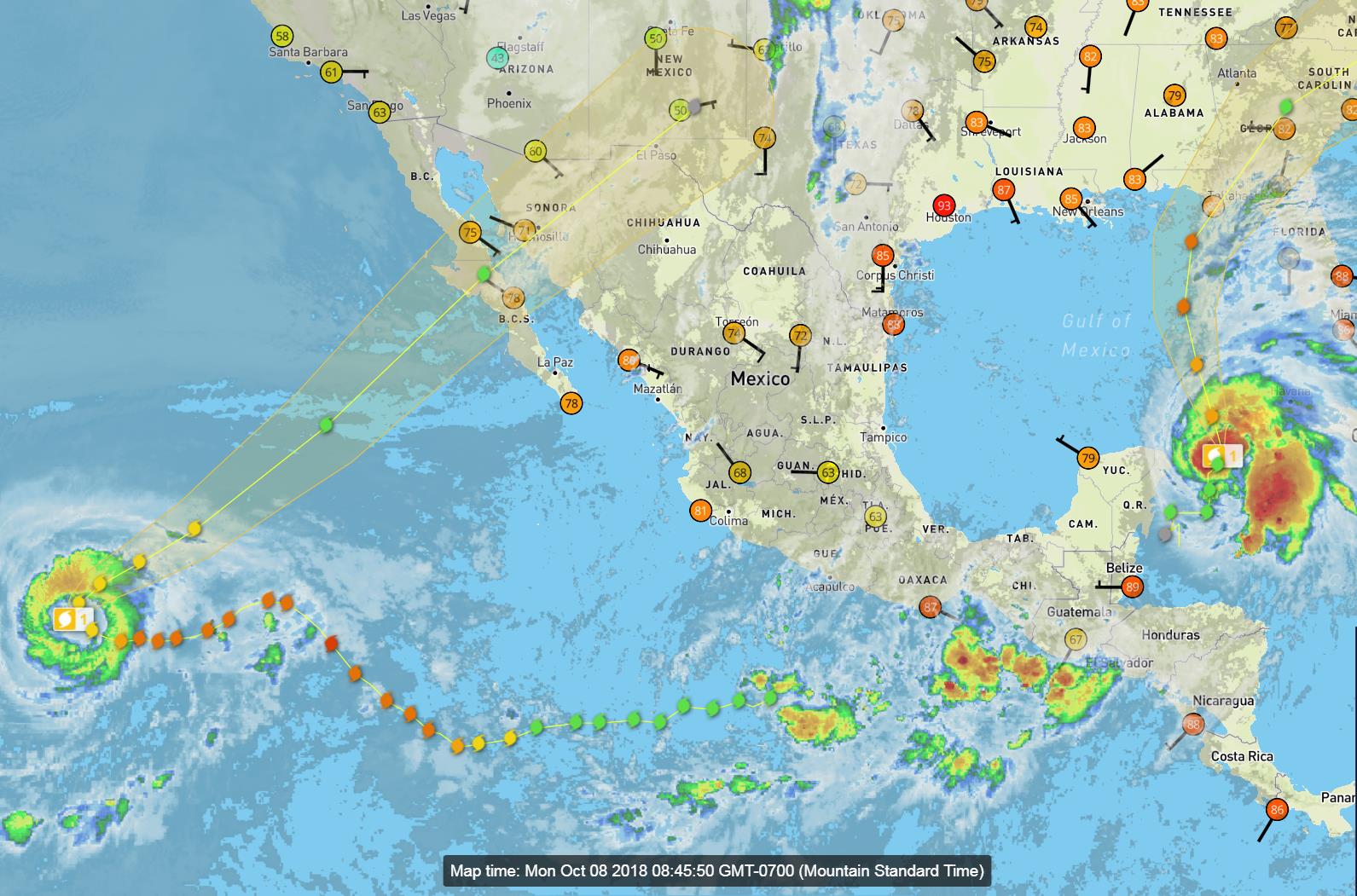
Hurricane Sergio continues to drift to the northwest over the open waters of east Pacific today, well away from any landmasses. Later tonight and Tuesday, Sergio will begin to move northeast toward the Baja Peninsula, where it could make landfall sometime later this week, probably as a tropical storm or tropical depression. Moisture from Sergio should then expand over northwestern Mexico and accelerate northward into the southwestern United States by Friday, leading to the potential for heavy rainfall.
By AccuWeather Senior Meteorologist Paul Walker
But I'll add that Thursday we took the highway toward Mayan Palace and were among the first they let through. Rio Sonoyta was running deep across the road in several place and a railroad bridge had collapsed. Sunday we returned from Puerto Lobos expecting to find only mud on the road, but instead the water was still running and we had to go very slow in a 4WD truck. Passenger cars were making it but barely. We believe they had diverted water from beneath the train bridge so they could repair the bridge, resulting in runoff being concentrated in just a couple of crossings. When we passed over Rio Sonoyta again about halfway to Sonoita (that bridge over a usually dry wash) it was still running fast. The river's headwaters are in the US and it collects over a wide area. And the ground is really saturated now.
The message here is that there are more variables at work than just the rain forecast.
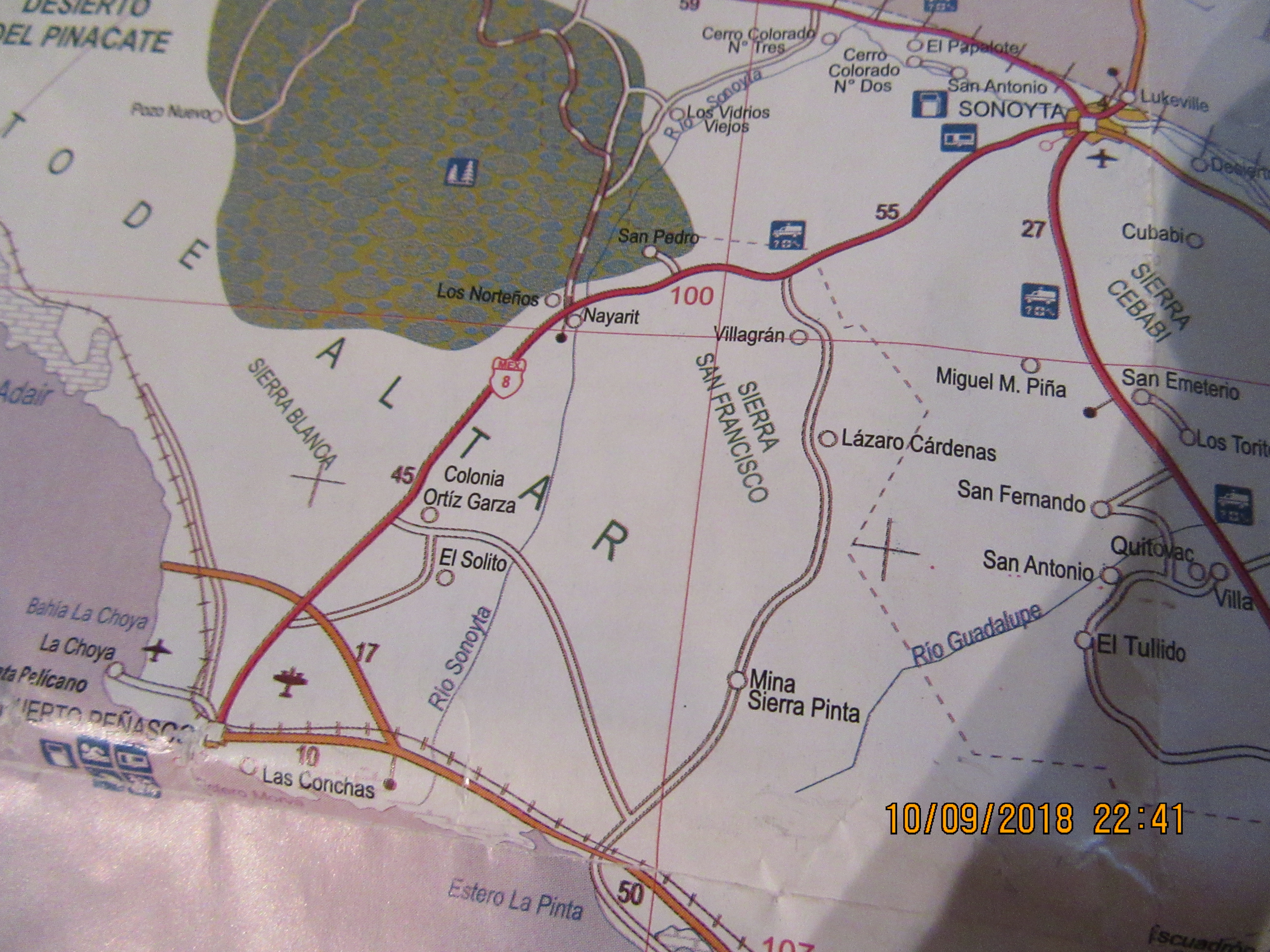
If your friends are really determined to reach Mayan Palace, you might inquire about turning off Highway 8 roughly 40 kilometers past Sonoyta. My map shows this road going past the Sierra Pinta mine and leading right to the Mayan Palace. It completely avoids the flood area. But since I've never taken this road myself, I advise getting confirmation from someone who knows for sure that this road does what my map says it does. And someone would need to tell you where to turn off of Highway 8. It looks to be about 40 kilometers past Sonoyta.
If your friends are really determined to reach Mayan Palace, you might inquire about turning off Highway 8 roughly 40 kilometers past Sonoyta. My map shows this road going past the Sierra Pinta mine and leading right to the Mayan Palace. It completely avoids the flood area. But since I've never taken this road myself, I advise getting confirmation from someone who knows for sure that this road does what my map says it does. And someone would need to tell you where to turn off of Highway 8. It looks to be about 40 kilometers past Sonoyta.
I think that road has been discussed on here. If it’s the one I’m thinking of I remember it being more of a Jeep trail.
Here's what I was talking about. Head out of Sonoyta like you normally do and take the road that leads past Villegran. But only after someone who knows this road confirms that it goes thru as shown and is in decent shape.
They THINK Sergio will go further south at this point, but... it's a hurricane. They go where they want to go and it's still like 1200 miles out and only moving at 3 mph.
Watch the weather. If your friends are really determined to reach Mayan Palace, you might inquire about turning off Highway 8 roughly 40 kilometers past Sonoyta. My map shows this road going past the Sierra Pinta mine and leading right to the Mayan Palace. It completely avoids the flood area. But since I've never taken this road myself, I advise getting confirmation from someone who knows for sure that this road does what my map says it does. And someone would need to tell you where to turn off of Highway 8. It looks to be about 40 kilometers past Sonoyta.
The "Road' is at best a Jeep trail and not to be tried solo. That's Gillespies old road he built to get to the mine and his hacienda on the Estro La Pinta, Read about it in Gilliespies Gold, the book.
I have not been there for a few years. The military closed off the road to the mine. Told me they had a shooting range across the road !! I passed a 4WD club of about 10 vehicles coming out about 10 years ago. I was at the mine when they came through looking all battered with a determined look on their faces!!
I'd love to try again. Who wants to go ?? Need 4WD.
Here's what I was talking about. Head out of Sonoyta like you normally do and take the road that leads past Villegran. But only after someone who knows this road confirms that it goes thru as shown and is in decent shape.
Hey great Map. Where did you get it?? Not real accurate but I LOVE maps. But as posted, it's not really a road.
Roberto, it's a Mexican map with no date of publication but obviously before 2010 as it doesn't show the highway going all the way to Libertad. I'd like to have an updated version.
Roberto, it's a Mexican map with no date of publication but obviously before 2010 as it doesn't show the highway going all the way to Libertad. I'd like to have an updated version.
I have, somewhere in the computer files, a government produced map that states it show ALL the roads in Sonora. I'll try to find it again. Wish there were Geodetic Survey like maps available. I have them of every scale of the Gila in New Mexico !